
|
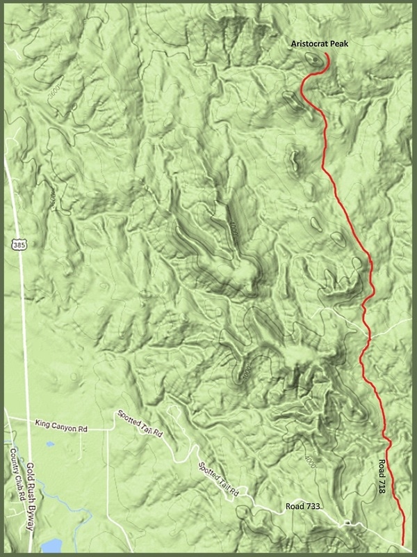
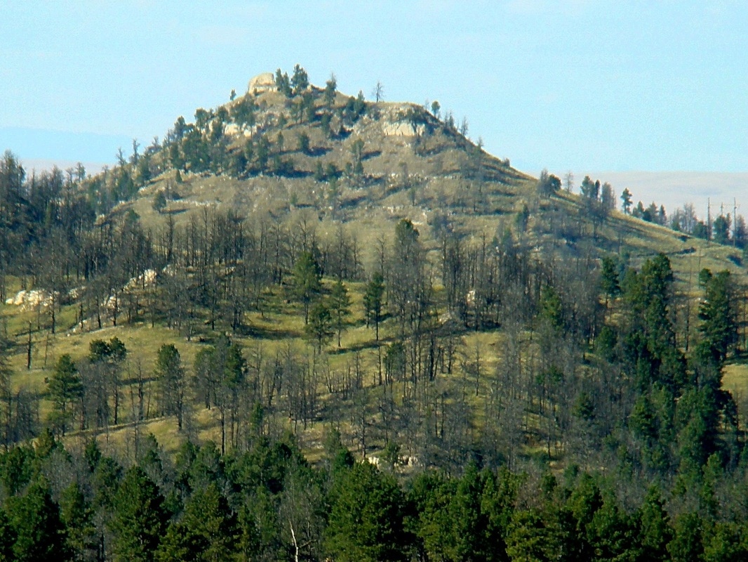
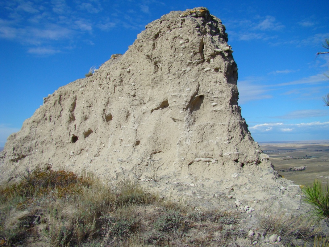
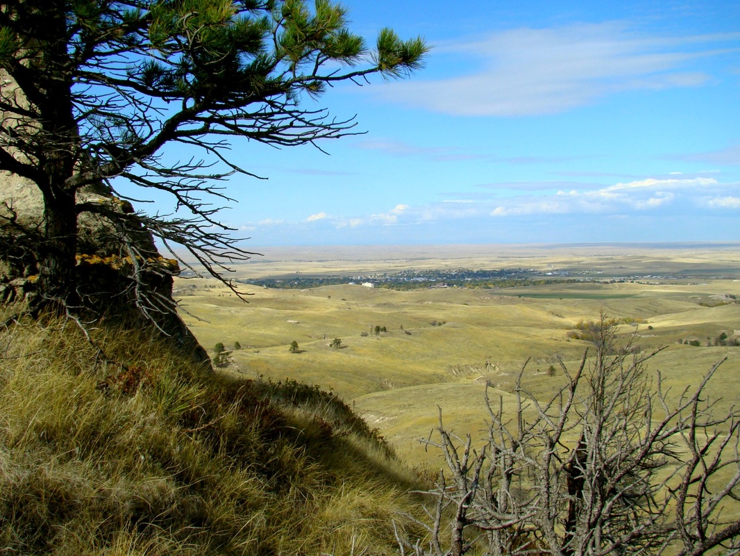
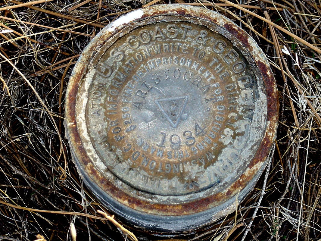
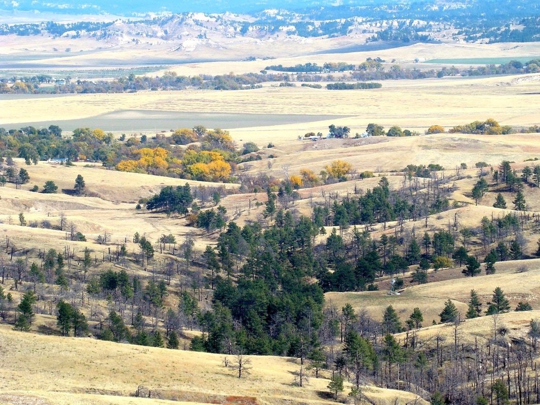
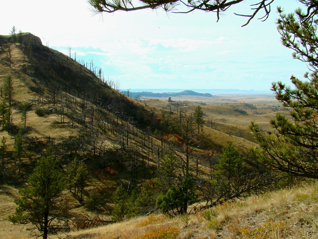
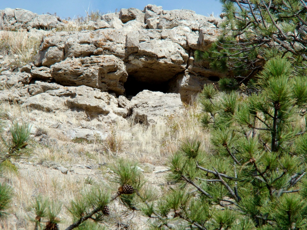
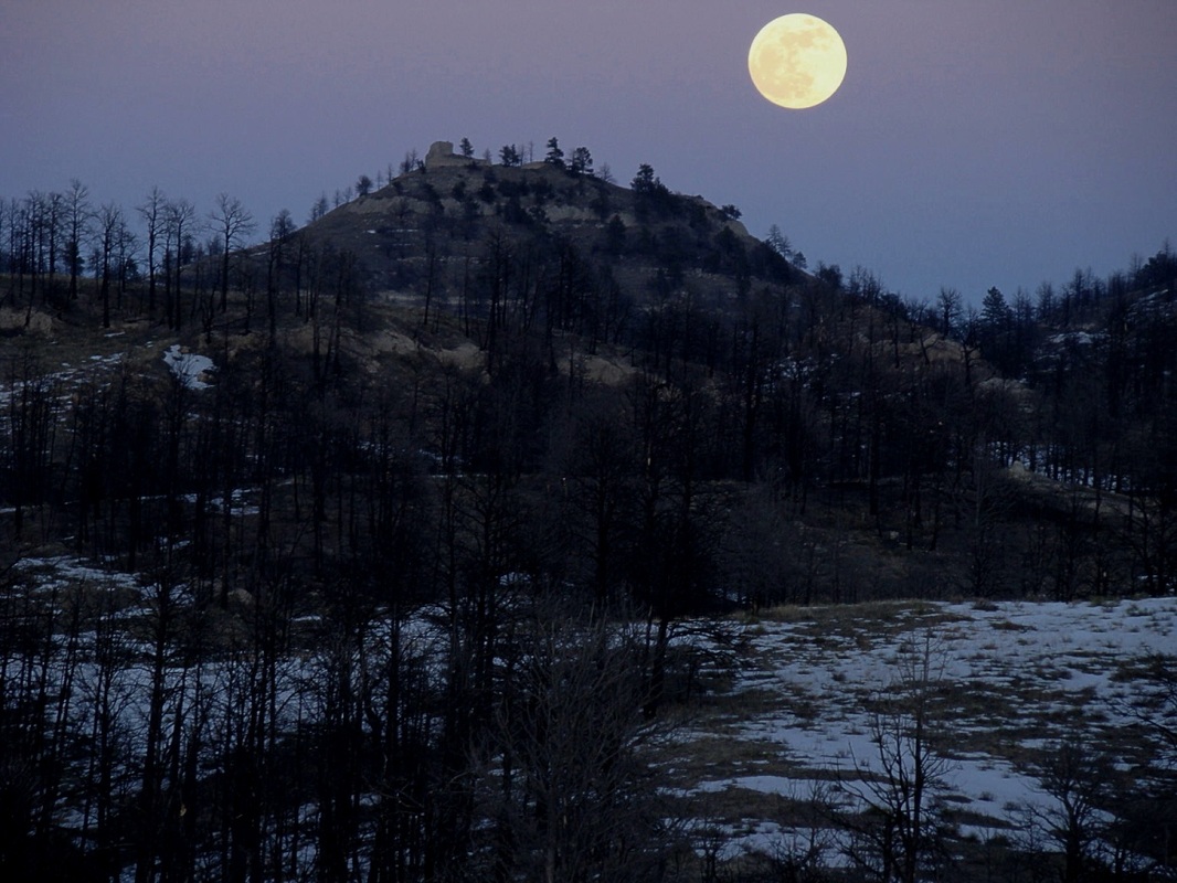
Standing almost 800 feet higher than the city of Chadron just 3 miles northwest, Aristocrat Peak is one of the most prominent summits in the Pine Ridge to the south. Early settlers referred to the peak as "The Old Aristocrat". The actual hike up the peak is not all that difficult and is similar to the hike up Roundtop Peak, 30 miles to the west. Near the summit, on the south side, is a shallow cave. Caution is warranted here, as it is just the right size for a den. There are two brass geodetic markers at the top of Aristocrat. Also, there is a pinnacle formed of some kind of rock composite. The view is great, though a little obscured to the south-southwest by an unnamed "twin" peak. To get to Aristocrat Peak, go south of Chadron on Highway 385 about 5 miles south, then turn east on King Canyon Road and go about 1/2 mile to the junction with Road 733. Follow 733 as it winds around through the 2006 burn area and over a steep ridge. At 2.8 miles, you should arrive at a poorly-kept road, 718. Follow this north 3.2 miles to the base of Aristocrat Peak. You will have to pass through 2 gates in the process, so please be sure to close the gates after you go through. Road 718 is very rough, even for Jeeps. So you might want to just hike in part or all of the way. Forest service rules allow you to pull a little ways off the roadway if you need to. This area is kind of remote, so you might have it all to yourself.
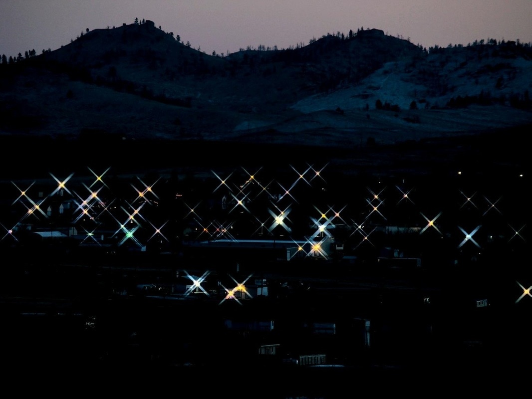
Evening lights in Chadron below the silhouette of Aristocrat Peak
|
For God alone, O my soul, wait in silence, for my hope is from him. He only is my rock and my salvation, my fortress; I shall not be shaken. On God rests my salvation and my glory; my mighty rock, my refuge is God. Trust in him at all times, O people; pour out your heart before him; God is a refuge for us. Psalm 62:5-8

