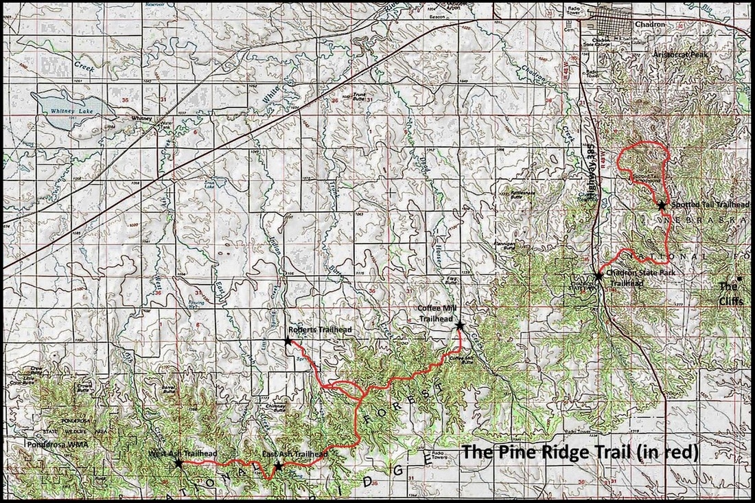
Pine Ridge Trail Map, including Roberts Loop Trail
|
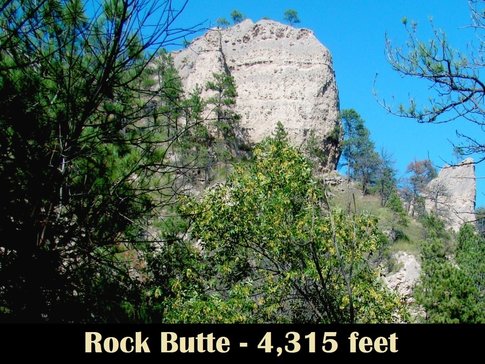
Rock Butte is hard to find labeled on topo maps, but can be located as the high point on the Rock Butte Trail that connects to a point on the Pine Ridge Trail about midway between the Coffee Mill and East Ash trailheads. Rock Butte is more like a minor ridge system than it is like a peak. It's hard to find the true highpoint since it branches out on a nearly-level summit. But it does give climbers a number of options for getting to the top and exploring.
To get to the Roberts Trailhead, the best route may be to travel west from Chadron on Highway 20 about 4 miles to Deadhorse Road. Go south on Deadhorse about 6 miles to Grantham Road. Go west 1 mile, then south 1 mile, then west 2 miles on Dry Creek Road, then south 1 mile, then east 2 miles on Faulk Road, then south 2 miles on Elleson Road. At the junction of Faulk Road and Bethel Road, you will see Bethel Church. Turn east there and travel about 1 3/4 miles to the Roberts Trailhead. At the trailhead, you will see a corral, a large parking area, a camping area, and a vault toilet. The trailhead sign is by the corral. From the corral, you will have to hike about 1 mile to a trail junction sign. The Roberts Trail goes east to a junction with the Pine Ridge Trail, while the Rock Butte Trail goes west, with a slow, steady ascent that ends at the summit. If you want to hike a different route back, continue on to the Pine ridge Trail, go east about 1/4 mile, then back north on the Roberts Trail, which will take you back to the trail junction you started at. |
Great is the Lord, and greatly to be praised, in the city of our God, His holy mountain. Beautiful in elevation, the joy of the whole earth, is Mount Zion in the far north, the city of the great King. Psalm 48:1-2
